Geospatial Information Systems (GIS)
Geospatial Information Systems, commonly referred to as GIS , is a computer-based tool used for capturing, storing, analyzing, and displaying geographically referenced data. This technology has become an essential component in various field…
Geospatial Information Systems, commonly referred to as GIS, is a computer-based tool used for capturing, storing, analyzing, and displaying geographically referenced data. This technology has become an essential component in various fields such as urban planning, natural resource management, and emergency response. The primary function of GIS is to provide a framework for integrating and analyzing different types of data, including spatial and non-spatial data, to gain insights and make informed decisions.
One of the key concepts in GIS is the idea of georeferencing, which involves assigning spatial coordinates to data, allowing it to be linked to a specific location on the earth's surface. This is achieved through the use of spatial references, such as latitude and longitude, or projection systems, which enable the representation of the earth's surface on a flat surface. The most common projection systems used in GIS are the Universal Transverse Mercator (UTM) and the State Plane Coordinate System.
Another fundamental concept in GIS is the use of layers, which are essentially datasets that can be overlaid on top of each other to create a comprehensive view of a particular area. These layers can include a variety of data types, such as raster data, which represents continuous phenomena, like imagery or elevation models, and vector data, which represents discrete features, like roads or buildings. The use of layers allows users to analyze and visualize complex relationships between different datasets, enabling the identification of patterns and trends that may not be apparent when examining individual datasets in isolation.
In addition to layers, GIS also utilizes attributes, which are essentially tables of information that describe the characteristics of features within a dataset. These attributes can include a wide range of data, such as demographic information, economic data, or environmental characteristics, and are used to analyze and understand the relationships between different features and phenomena. The use of attributes enables users to perform complex analyses, such as spatial joins and spatial autocorrelation, which can provide valuable insights into the patterns and relationships within a dataset.
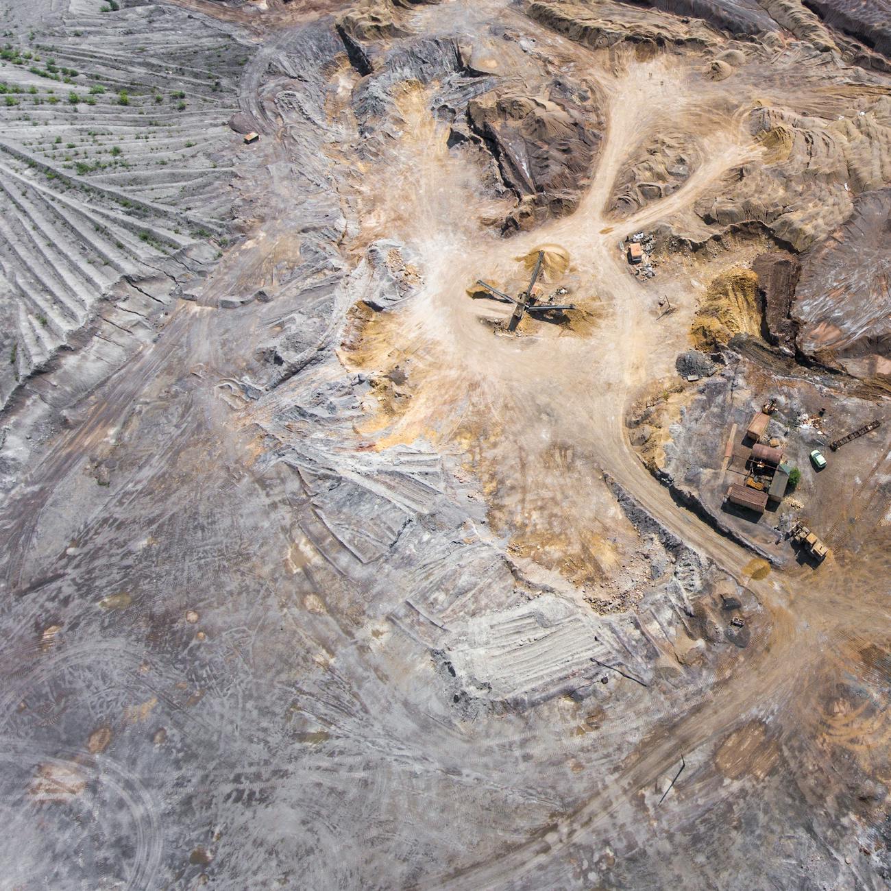
The use of GIS in aerial surveillance systems is particularly significant, as it enables the analysis and visualization of large amounts of data collected from unmanned aerial vehicles (UAVs) or manned aircraft. This data can include imagery, video, and sensor data, which can be used to monitor and track a wide range of phenomena, from weather patterns to wildlife populations. The integration of GIS with aerial surveillance systems enables the creation of comprehensive and dynamic maps, which can be used to support a variety of applications, including disaster response, environmental monitoring, and national security.
One of the key challenges in using GIS in aerial surveillance systems is the management and analysis of large amounts of data. The sheer volume of data collected from UAVs or manned aircraft can be overwhelming, and requires the use of specialized software and hardware to process and analyze. Additionally, the integration of GIS with aerial surveillance systems requires careful consideration of issues such as data quality, spatial accuracy, and temporal resolution, which can have a significant impact on the accuracy and reliability of the results.
Despite these challenges, the use of GIS in aerial surveillance systems has the potential to revolutionize a wide range of fields, from environmental monitoring to national security. The ability to collect and analyze large amounts of data from UAVs or manned aircraft enables the creation of comprehensive and dynamic maps, which can be used to support a variety of applications, including disaster response, wildlife conservation, and infrastructure management. Furthermore, the integration of GIS with aerial surveillance systems enables the use of advanced analytics and machine learning algorithms, which can provide valuable insights into patterns and trends within the data.
In terms of practical applications, GIS is used in a wide range of fields, including urban planning, transportation management, and emergency response. For example, GIS can be used to analyze and visualize traffic patterns, enabling the optimization of traffic flow and the reduction of congestion. Similarly, GIS can be used to analyze and visualize emergency response data, enabling the identification of high-risk areas and the optimization of emergency response strategies.
The use of GIS in environmental monitoring is also significant, as it enables the analysis and visualization of large amounts of data related to climate change, deforestation, and pollution. For example, GIS can be used to analyze and visualize satellite imagery, enabling the monitoring of deforestation and the identification of high-risk areas. Similarly, GIS can be used to analyze and visualize sensor data, enabling the monitoring of air quality and the identification of high-pollution areas.
In addition to these applications, GIS is also used in a wide range of other fields, including agriculture, forestry, and mining. For example, GIS can be used to analyze and visualize soil quality data, enabling the optimization of crop yields and the reduction of soil erosion. Similarly, GIS can be used to analyze and visualize mineral deposits, enabling the identification of high-value areas and the optimization of mining operations.
The use of GIS in aerial surveillance systems also has the potential to support a wide range of research applications, including the study of climate change, deforestation, and wildlife conservation. For example, GIS can be used to analyze and visualize satellite imagery, enabling the monitoring of deforestation and the identification of high-risk areas.
In terms of challenges, the use of GIS in aerial surveillance systems requires careful consideration of issues such as data quality, spatial accuracy, and temporal resolution. Additionally, the integration of GIS with aerial surveillance systems requires the use of specialized software and hardware, which can be expensive and require significant computational resources. Furthermore, the use of GIS in aerial surveillance systems also raises concerns about privacy and security, as the collection and analysis of large amounts of data can have significant implications for individual privacy and national security.
In terms of future directions, the use of GIS in aerial surveillance systems is likely to continue to evolve and expand, with the development of new technologies and analytical methods. For example, the use of artificial intelligence and machine learning algorithms is likely to become more prevalent, enabling the automated analysis and interpretation of large amounts of data. Additionally, the integration of GIS with aerial surveillance systems is likely to become more widespread, with the use of cloud computing and big data analytics enabling the processing and analysis of large amounts of data in real-time.
The use of GIS in aerial surveillance systems also has the potential to support a wide range of new applications, including the monitoring of climate change, deforestation, and wildlife conservation.
In addition to these applications, the use of GIS in aerial surveillance systems also has the potential to support a wide range of research applications, including the study of climate change, deforestation, and wildlife conservation.
The use of GIS in aerial surveillance systems requires a range of technical skills, including programming skills, data analysis skills, and spatial analysis skills. For example, users need to be able to write code to automate tasks, analyze data, and visualize results. Additionally, users need to be able to work with large datasets, including raster data and vector data, and perform spatial joins and spatial autocorrelation analysis.
In terms of education and training, there are a range of courses and programs available that teach the skills and knowledge required to use GIS in aerial surveillance systems. For example, users can take online courses or certificate programs that teach GIS fundamentals, spatial analysis, and programming skills. Additionally, users can attend conferences and workshops that provide hands-on training and networking opportunities.
The use of GIS in aerial surveillance systems also requires a range of software and hardware, including GIS software, remote sensing software, and computer hardware. For example, users need to have access to GIS software such as ArcGIS or QGIS, as well as remote sensing software such as ENVI or ERDAS. Additionally, users need to have access to computer hardware such as laptops or desktops, as well as storage devices such as hard drives or solid state drives.
In terms of best practices, there are a range of guidelines and standards that users can follow to ensure the effective use of GIS in aerial surveillance systems. For example, users should follow data quality guidelines to ensure that data is accurate and reliable, and should use standardized protocols for data collection and analysis. Additionally, users should follow security protocols to ensure that data is protected and access controls are in place to prevent unauthorized access.
The use of GIS in aerial surveillance systems also has the potential to support a wide range of policy and decision-making applications, including disaster response, environmental monitoring, and national security. For example, GIS can be used to analyze and visualize data related to disaster response, enabling the identification of high-risk areas and the optimization of response strategies. Similarly, GIS can be used to analyze and visualize data related to environmental monitoring, enabling the monitoring of air quality and the identification of high-pollution areas.
In addition to these applications, the use of GIS in aerial surveillance systems also has the potential to support a wide range of research and development applications, including the study of climate change, deforestation, and wildlife conservation.
The use of GIS in aerial surveillance systems requires a range of interdisciplinary skills, including technical skills, analytical skills, and communication skills. For example, users need to be able to work with large datasets, including raster data and vector data, and perform spatial joins and spatial autocorrelation analysis. Additionally, users need to be able to communicate complex results to stakeholders and decision-makers, using visualizations and reports to convey key findings and recommendations.
In terms of future research directions, there are a range of areas that require further study, including the development of new analytical methods, the integration of GIS with other technologies, and the application of GIS to new domains. For example, researchers could explore the use of machine learning algorithms to analyze and interpret large datasets, or the integration of GIS with Internet of Things (IoT) devices to enable real-time monitoring and analysis. Additionally, researchers could apply GIS to new domains, such as public health or urban planning, to support decision-making and policy development.
The use of GIS in aerial surveillance systems also requires a range of collaboration and partnership opportunities, including government agencies, private industry, and academic institutions. For example, users could collaborate with government agencies to develop and implement GIS-based solutions for disaster response and environmental monitoring. Additionally, users could partner with private industry to develop and deploy GIS-based technologies for infrastructure management and resource allocation. Furthermore, users could collaborate with academic institutions to develop and apply new analytical methods and technologies to support research and development applications.
In terms of challenges and limitations, there are a range of issues that need to be addressed, including data quality, spatial accuracy, and temporal resolution. For example, users need to ensure that data is accurate and reliable, and that spatial accuracy is maintained throughout the analysis and visualization process. Additionally, users need to consider temporal resolution issues, such as the frequency of data collection and the timing of data analysis. Furthermore, users need to address privacy and security concerns, such as the protection of sensitive information and the prevention of unauthorized access.
The use of GIS in aerial surveillance systems also requires a range of standards and protocols, including data standards, communication protocols, and security protocols. For example, users need to follow data standards to ensure that data is accurate and reliable, and that communication protocols are in place to enable the sharing and integration of data. Additionally, users need to follow security protocols to ensure that data is protected and that access controls are in place to prevent unauthorized access.
In terms of education and training, there are a range of resources available to support the development of GIS skills and knowledge, including online courses, certificate programs, and workshops.
Additionally, users should follow security protocols to ensure that data is protected and that access controls are in place to prevent unauthorized access.
The use of GIS in aerial surveillance systems has the potential to revolutionize a wide range of fields, from environmental monitoring to national security.
Key takeaways
- The primary function of GIS is to provide a framework for integrating and analyzing different types of data, including spatial and non-spatial data, to gain insights and make informed decisions.
- One of the key concepts in GIS is the idea of georeferencing, which involves assigning spatial coordinates to data, allowing it to be linked to a specific location on the earth's surface.
- The use of layers allows users to analyze and visualize complex relationships between different datasets, enabling the identification of patterns and trends that may not be apparent when examining individual datasets in isolation.
- The use of attributes enables users to perform complex analyses, such as spatial joins and spatial autocorrelation, which can provide valuable insights into the patterns and relationships within a dataset.
- The use of GIS in aerial surveillance systems is particularly significant, as it enables the analysis and visualization of large amounts of data collected from unmanned aerial vehicles (UAVs) or manned aircraft.
- The sheer volume of data collected from UAVs or manned aircraft can be overwhelming, and requires the use of specialized software and hardware to process and analyze.
- Furthermore, the integration of GIS with aerial surveillance systems enables the use of advanced analytics and machine learning algorithms, which can provide valuable insights into patterns and trends within the data.